D-Geo 0.95
Continue to app
Paid Version
Publisher Description
D-Geo - Online, offline and custom maps, points database with any EPSG projection.
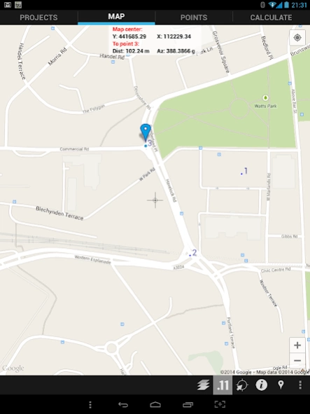
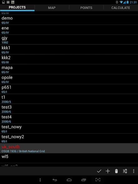
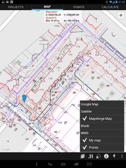
This application allow you to manage points in any coordinate projection (all EPSG defined coordinate systems are supported). Points are painted on map. You can choose from online google maps, any WMS server or use offline solution based on Mapsforge maps (for example from http://www.openandromaps.org/ - please support this great project if you find them useful).
Application can also paint your own map. You can prepare data for android app thanks to PC application (you can download it for free from http://d-geo.pl). This application can import points from txt or xls files, import vector or raster data from many formats: Autocad (dxf, dwg), Microstation (dgn), ArcView shape (shp), Google Earth (kml), GML, GPX, MapInfo (mif, tab), geotiff and other. All imported files are combined into one dgeo project file used in android app. Map part are prepared as tiles – so this take a some time and some disk space (using only points produced small files). Since the v.0.94 map can be exported also as vectors. PC application can send your project file to android device (logged in the same wi-fi network). You can also put dgeo project file to Dropbox or copy directly to D-GEO directory on SD card.
Point from points list can be easy locate on map by long tap on them. You can add points by tap on map or writing their coordinates.
Info panel on map can show your position and distance/azimuth to selected point (all coordinates are presented in project specified projection).
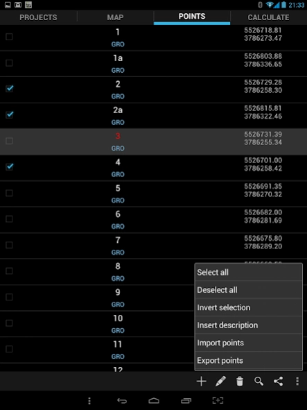
Points can be:
- add, edit, delete
- shared to other applications as position, navigation and street view,
- exported and imported from/to txt files
App have built simple calculations:
- azimuth, distance between two points
- lines intersection (lines defined by two points each)
- point reprojection from any coordinate system to actually used
- angle from coordinates
- linear intersection
- angular intersection
- 3 point resection
Tags: GIS, geodesy, survey, land surveying
About D-Geo
D-Geo is a paid app for Android published in the PIMS & Calendars list of apps, part of Business.
The company that develops D-Geo is droidgeo. The latest version released by its developer is 0.95.
To install D-Geo on your Android device, just click the green Continue To App button above to start the installation process. The app is listed on our website since 2015-03-10 and was downloaded 10 times. We have already checked if the download link is safe, however for your own protection we recommend that you scan the downloaded app with your antivirus. Your antivirus may detect the D-Geo as malware as malware if the download link to com.m6.droidgeo is broken.
How to install D-Geo on your Android device:
- Click on the Continue To App button on our website. This will redirect you to Google Play.
- Once the D-Geo is shown in the Google Play listing of your Android device, you can start its download and installation. Tap on the Install button located below the search bar and to the right of the app icon.
- A pop-up window with the permissions required by D-Geo will be shown. Click on Accept to continue the process.
- D-Geo will be downloaded onto your device, displaying a progress. Once the download completes, the installation will start and you'll get a notification after the installation is finished.
